
Walk a Morgantown Street by Address
The strongest street directory search begins with one complete address, not just a surname. Morgantown property evidence is divided among the Monongalia County Assessor, County Clerk, Sheriff Tax Office, statewide parcel viewer, and year-specific directories. Record the source date beside every name. A current owner, a taxpayer, a registered voter, and a person listed in a directory may all be different people.
- Enter the street and city in the Monongalia County Assessor Parcel Search. Save the district, map, parcel, owner, property address, and deed book/page.
- Open the same parcel in the West Virginia Parcel Viewer. Confirm its E-911 address and physical location, then inspect nearby parcel shapes one at a time.
- Use the County Clerk recorded-document index to verify the deed reference. Search the indexed parties and document image when available.
- Check the official voter lookup only when you have a person's first name, last name, and birth date. It is not an open street roster.
- For an earlier household, consult a dated Morgantown directory, newspaper, or map. Label the finding as "listed at" rather than as proof of present occupancy.
This order keeps ownership and residence apart. It also gives the Morgantown street directory a clear audit trail when a mailing address differs from the parcel's situs address, which means the physical location used for assessment.
Search Morgantown Assessor Street Fields
The county parcel form supports much more than a basic owner search. Street Name and City are separate fields, and the current/history checkbox changes the kind of result returned. The form does not show a dedicated ZIP field. Its filters can narrow a busy Morgantown street by parcel geography, transfer detail, or property trait.
| Field group | Visible controls | Street-directory use |
|---|---|---|
| Address and owner | Street Name, City, last/first name, business | Find parcels tied to an address or indexed owner |
| Parcel geography | District, map, parcel, range, development, area | Separate like street names and adjoining tax parcels |
| Transfer details | Deed type, book, page, date and sale-price ranges | Carry a property hit into the recorded deed index |
| Land details | Acreage, plat, multiples, life estate, minerals | Spot conditions that may explain unusual ownership results |
| Time | Checked for current parcel; unchecked for history | Compare the tax-year card with prior parcel records |
The portal says current data reflects the current tax year and is updated throughout the year. Its maps come from paper map cards and are not legal surveys. In a street directory search, verify title through the County Clerk rather than treating a tax-map line as a deed boundary.
The county parcel search screen shows how the address and history controls fit together.
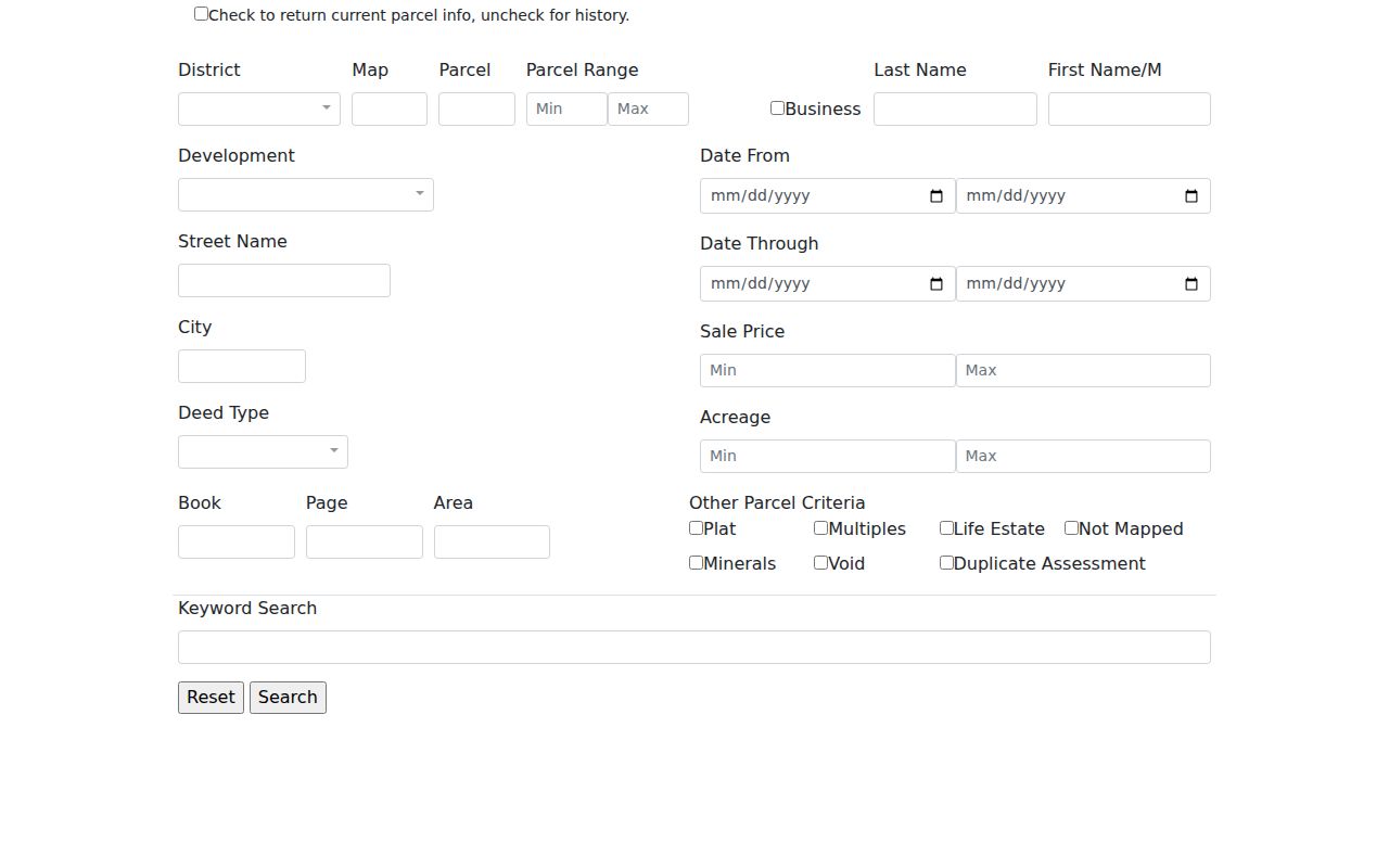
The captured form is useful as a field map. A result still needs a deed check and a date before it becomes reliable street evidence.
Map Morgantown Parcels Street by Street
The county GIS site returned a gateway error during research, so the documented fallback is the statewide WV Parcel Viewer. Search a parcel address, zoom to the subject polygon, turn on details or highlighting, and note the E-911 address. The viewer can expose owner, physical address, building and appraisal categories, flood information, and links to outside map services.
No radius or buffer tool was found. For a street directory, open each adjacent parcel separately and copy its root parcel ID or district, map, and parcel values. A parcel is a mapped unit used for tax and land records. A plat is a recorded drawing of lots or subdivisions. Neither proves that two owners know each other or that the named owner lives there.
The WV Parcel Viewer supplies the map layer when Morgantown's county viewer cannot be reached.
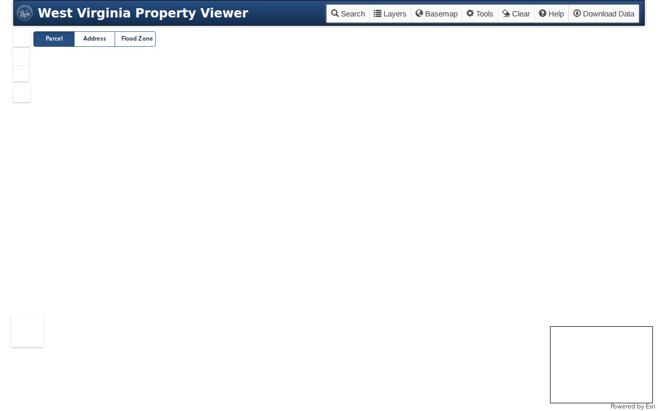
This map is best for geographic continuity in the Morgantown street directory. The County Clerk's recorded legal description remains the stronger source for title and lot boundaries.
Read Morgantown Address Terms
Small labels can change the result of a by-address search. Keep them in an evidence ledger with the source year and exact spelling.
- Parcel
- A tax and map unit identified by district, map, and parcel numbers.
- Situs address
- The physical address of the property, which may differ from the owner's mailing address.
- Plat
- A recorded plan that shows lots, lines, streets, or a subdivision.
- Criss-cross directory
- A directory arranged by street or telephone number instead of only by surname. No separately named digitized Morgantown run was confirmed.
Use these terms to describe what a record says. Do not turn an owner field into an occupant claim, or a directory listing into a legal-title claim.
Morgantown Street Records and Keepers
No single Morgantown street directory contains every household. The most useful address-keyed sources have different custodians, dates, and limits. Start online when possible, then use the office, library, or archive route when an index is incomplete.
| Record Set | Keeper | What It Shows | Access |
|---|---|---|---|
| Parcel and map card | Monongalia County Assessor | Tax-year owner, parcel ID, property address, deed references | Web search or Room 335, 243 High St. |
| Recorded documents | Monongalia County Clerk | Indexed parties, instrument, book/page, date, legal description | Web index, public computer, or copies in Room 123 |
| Tax ticket | Monongalia County Sheriff | Taxpayer, ticket, account, year, district/map/parcel | Online inquiry or Room 300 |
| Municipal record | Morgantown City Clerk and Code Enforcement | Minutes, deeds, ordinances, permits or compliance context | Office request; public permit portal not confirmed |
| Historical address | State Archives, WVRHC, library | Dated name listing, ward, street, occupation, map footprint | Digitized volumes, onsite books, microfilm, or staff request |
The street name connects sources, but the parcel number is safer when names change. Monongalia County's electronic deed cutoff was not found in official material. If a record does not appear online, call the Clerk at 304-291-7230 or use the courthouse public computer and copy service. The Assessor is at 304-291-7222, and the Sheriff Tax Office is at 304-291-7244.
Carry Morgantown Addresses Into Deeds
The County Clerk's Electronic Records Search offers Index, Image, and Vault modes. Official help documents individual and firm names, book/page, instrument number, part of a legal description, and a recording-date range. Partial names use a percent separator. Date searches are limited to one year, and broad legal-description searches may take several minutes.
A recorded deed is the best evidence of a transfer or legal interest, but it does not prove residence. Begin with the deed book/page on the parcel card, then confirm the indexed party, instrument type, recording date, and legal-description clue. If an image is available, read it. Otherwise, request the document from the Clerk.
The recorded-index search help shows the supported search modes.
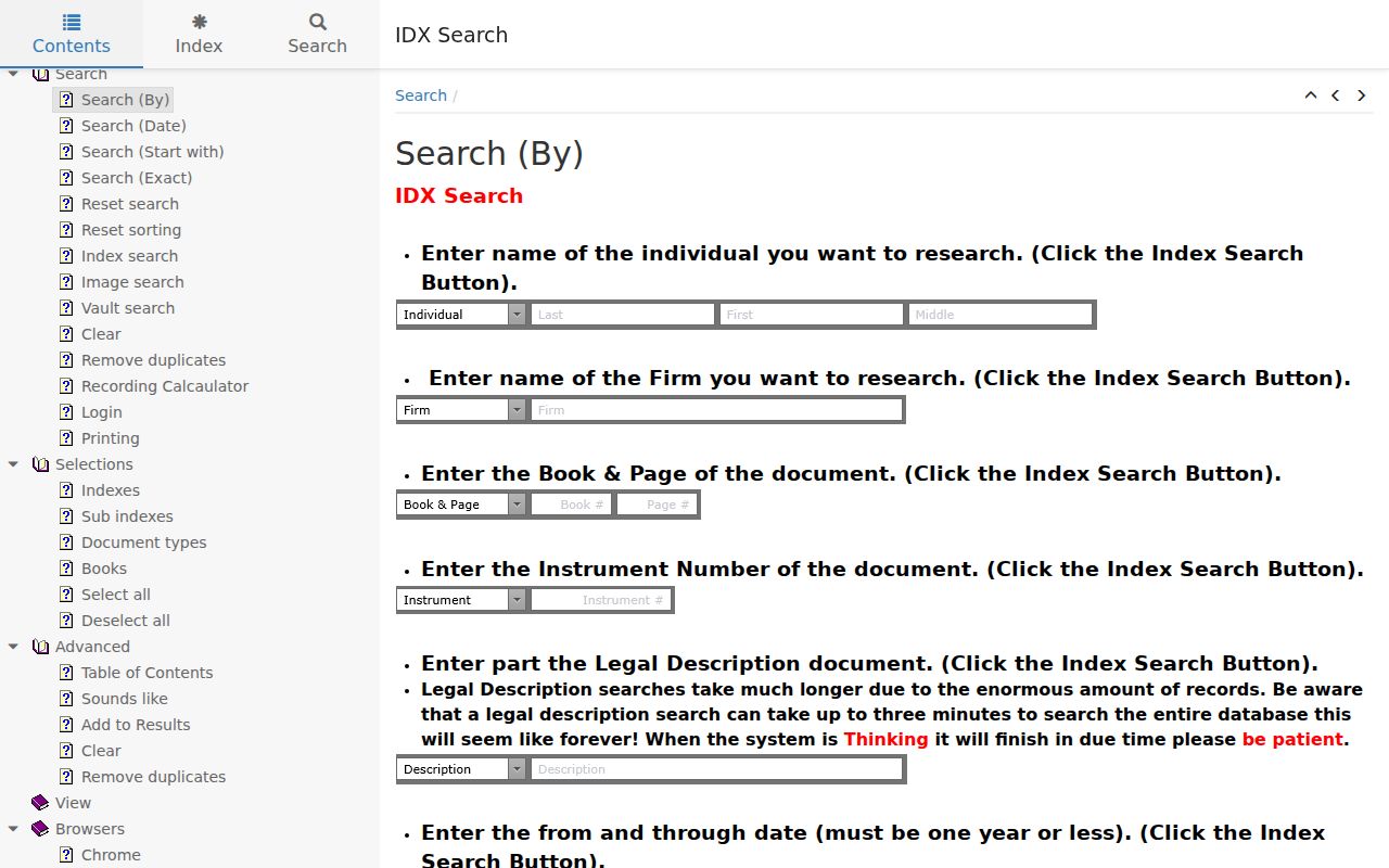
The help screen is evidence of available search paths, not a sample deed result. No stable Morgantown deed result was captured.
Note: Keep the parcel ID and deed citation together because street wording alone can change across tax cards, maps, and old volumes.
Normalize Morgantown Street Names
Morgantown's Old Stone House gives a compact warning about historical addresses: it stood on Long Alley, now Chestnut Street. Search both names when moving between a deed, a map, and a directory. Preserve suffixes and directions too, including Street versus St., Avenue versus Ave., and Alley versus Lane.
The county's 9-1-1 addressing ordinance generally favors one street name along the full length of a road. In unincorporated areas, a later name-change petition requires support from owners of at least 80 percent of parcels with an addressed structure. That rule helps explain modern consistency, but it does not rewrite older records. Ward and community terms such as Greenmont, South Park, Seneca, Wiles' Addition, Sunnyside, and South Morgantown also belong in a historical search key.
See Morgantown Streets on Sanborns
Sanborn fire-insurance maps can settle whether a street, alley, building footprint, or nearby structure existed in a given mapped year. The Morgantown set grows from one sheet in 1892 to six in 1899, ten in 1904, fifteen in 1906, twenty-seven in 1911, and forty in 1921. Later coverage reaches Westover, South Sabraton, Granville, Riverside, Star City, and Sturgiss City.
A map does not name a resident. Pair its block evidence with a directory entry, recorded deed, tax card, or newspaper item from a close date. The map then explains physical continuity while the dated name source supplies the person link.
Request Morgantown Municipal Address Files
The Morgantown City Clerk keeps council minutes, municipal deeds, ordinances, resolutions, and other city-history records at 389 Spruce Street, Room 10. Code Enforcement and Development Services add a later property layer. City inspections began in 1979, and a written code dates to 1989. Research did not locate a public permit-search portal, so the documented route is an office request at 304-284-7401.
For non-exempt city or county administrative records, West Virginia's Freedom of Information Act supplies the inspection-and-copy baseline. Describe the address, date range, and record type. A focused request is more likely to reach the right custodian than a demand for every file tied to a street.
Separate Morgantown Address Layers
A Morgantown mailing label does not always mean the parcel lies within city limits. USPS delivery geography, census place geography, E-911 addresses, assessor situs entries, wards, and neighborhood names are different layers. Campus-associated and central-delivery ZIPs can point to an institution or mailbox rather than a home parcel.
Use the USPS address lookup for the delivery ZIP, then compare the returned label with the assessor and parcel viewer. Keep both values when they differ. That mismatch is a reason to inspect the exact location, not proof that either system is wrong.
Limits of a Morgantown Street Directory
Official address systems do not form a live list of everyone inside a home. The property roll names a tax-year owner. A deed records an interest or transfer. A directory is a dated listing, and a voter lookup requires identifying information for one person. Mailing and physical addresses may differ, and some records are withheld for safety or privacy.
Use the minimum facts needed for family history, property research, civic questions, or reconnecting. Confirm important findings with the custodian and keep the date attached. The West Virginia Address Confidentiality Program also supplies substitute addresses to qualifying survivors, so an address record may be intentionally shielded.
An empty search is not the same as a vacant address. Street spelling may have changed, a parcel may use a different city label, an instrument may fall before the unverified online cutoff, or a household may never have appeared in the source being checked. Repeat the search with the current E-911 form, any documented old street name, and the parcel's district-map-parcel identifier. Then use the office computer or ask the custodian about paper and archived material. Keep negative results in the evidence ledger with the exact query and date. That record prevents a later searcher from treating a portal limit as proof about who did or did not live along the street.
Lawful use. Morgantown street records are for lawful personal research. Never use an address or name to stalk, harass, threaten, or harm anyone.